

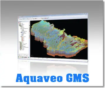
Aquaveo GMS v7.1.9

Aquaveo GMS v7.1.9 | 241 Mb
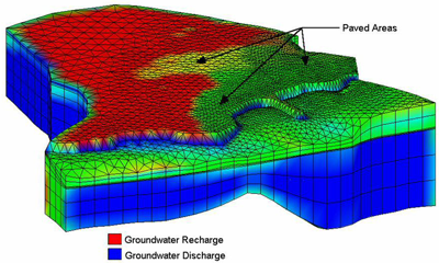
GMS is a comprehensive groundwater modeling environment with GIS based graphical preprocessing tools to automate and streamline the modeling process. GMS seamlessly interfaces with MODFLOW and several other preeminent groundwater models, and provides advanced graphical features for viewing and calibrating model results.
The Groundwater Modeling System (GMS) is a comprehensive graphical user environment for performing groundwater simulations. GMS consists of a graphical user interface (the GMS program) and a number of analysis codes (MODFLOW, MT3DMS, etc.). GMS is used as a preprocessor to graphically create numerical models, and as a post processor to import and visualize model results.
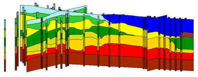
GMS uses a Conceptual Modeling Approach to create and manage numerical models using GIS based objects. Other powerful GMS features include 3D Model Conceptualization, Site Visualization, Advanced Geostatistics, Automated Calibration, and Stochastic Modeling. GMS also has advanced tools for Data Import, Data Export and Data Visualization and Animation.
Aquaveo GMS v7.1.9

Conceptual Model Approach
GMS is a powerful graphical tool for model creation. Models can be built using digital maps and elevation models for reference and source data. During the model building process, the graphical representation of the model allows quick review and presentation of your work.
One of GMS's greatest strengths is the conceptual model approach which allows users to build models conceptually independent of their numerical grid. This approach makes it possible to build a conceptual model using GIS feature objects (points, arcs, and polygons). The conceptual model defines the boundary conditions, sources/sinks, and material property zones for a model. The model data can then be automatically discretized to the model grid or mesh. The conceptual model approach makes it possible to deal with large, complex models in a simple and efficient manner.
Aquaveo GMS v7.1.9

The GIS Module now available in GMS has made creating conceptual models from GIS data even easier. With direct linkage to ArcGIS and almost any format of GIS data, you can access geometry and attributes faster than ever before. Whether the GIS data is created in GMS or imported from GIS files, the method of model building remains the same. The model is edited at the GIS object level. GMS automatically generates the mesh and assigns parameters and boundary conditions to each element of the model.
Other features:
- 3D Model Conceptualization
- Site Characterisation & Visualization
- Geostatistics
- Model Calibration
- Stochastic Modeling
- Visualization & Animation
- Data Import
- Data Export
http://www.filesonic.com/file/...aveo.GMS.v7.1.9-BEAN.part2.rar
http://www.filesonic.com/file/...aveo.GMS.v7.1.9-BEAN.part3.rar
http://www.unibytes.com/YYz9WN...aveo.GMS.v7.1.9-BEAN.part1.rar
http://www.unibytes.com/ptl5_y...aveo.GMS.v7.1.9-BEAN.part2.rar
http://www.unibytes.com/7zXtTT...aveo.GMS.v7.1.9-BEAN.part3.rar
No mirrors please
Welcome to my blog!