

Google Earth Plus 5.2.1.1547

Google Earth Plus 5.2.1.1547 | 13.8 MB
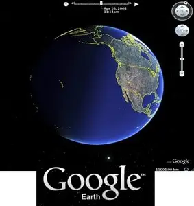
With Google Earth you can explore the earth from above! Want to know more about a specific location? Dive right in – Google Earth combines satellite imagery, maps and the power of Google Search to put the world's geographic information at your fingertips. Google Earth puts a planet's worth of imagery and other geographic information right on your desktop. View exotic locales like Maui and Paris as well as points of interest such as local restaurants, hospitals, schools, and more.
Key features of "Google Earth":
· Navigation controls - Look around, move and zoom into any location
· Sun and shadows - View animated shadows as they move across the landscape
· 3D buildings - View hundreds of photo-realistic new buildings in many of the world's cities
· Imagery date information
· Support for new language versions
· Flash videos in placemark balloons
· Fly from space to your neighborhood. Type in an address and zoom right in.
· Search for schools, parks, restaurants, and hotels. Get driving directions.
· Tilt and rotate the view to see 3D terrain and buildings.
· Save and share your searches and favorites. Even add your own annotations.
New Features in Google Earth 5.2
Improved embedded browser functionality: Better integration of embedded browser with Google Earth Application.
Track and Multitrack in Google Earth: A track allows you to create one visible object in Google Earth (either a Point icon or a Model) that moves over time between multiple positions. Using the time slider, you can animate position and orientation of an object and show a line tracing the path. A multitrack is a collection of tracks. You can create Track and Multitrack by authoring KML documents or by importing your GPS data (from a number of GPS receivers or file formats such as GPX) into Google Earth.
Elevation Profile in Google Earth: You can see elevation profile of a line-string or track in Google Earth. It plots the elevation profile, speed, and associated extended data (for example, heart rate) in a KML file.
Added file import types: NMEA (.log and .nmea), Garmin GDB, Garmin Training Center, and Ozi Explorer files can now all be read. Garmin fitness extensions are now read from GPX. Extended data for Elevation Profile and Track is handled when available.
Changes for Google Earth Plug-in 5.2
Enhanced Time support:
ability to toggle Historical imagery in Google Earth Plug-in (#235)
ability to create timestamps and timespans (#177).
ability to toggle time UI (#202)
ability to set plug-in’s clock rate. (#208, #143, #381, #419, #396)
ability to set the plug-in’s virtual time/clock (#104)
Improved accessors:
getUrl
getComputedStyle (#392)
getElementbyUrl
getElementbyId (fixed #60)g
getElementbyType
getElementsByStyleUrl
Access to Balloon Content
Ability to get balloon content using getBalloonDescription, getBalloonHtml, and getBalloonHtmlUnsafe (#16) (#97).