


GARMIN MAPSOURCE BLUECHART AMERICAS ver. 7.5
GARMIN MAPSOURCE BLUECHART AMERICAS v7.5
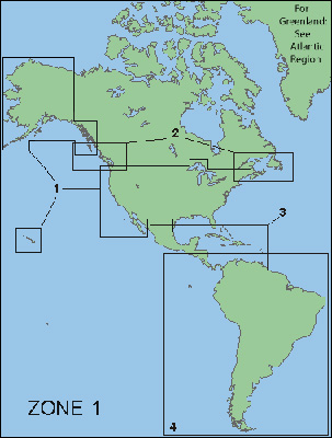
US, Canada, Caribbean, Central & South America
US, Canada, Caribbean, Central & South America
GARMIN MAPSOURCE BLUECHART AMERICAS ver. 7.5
Garmin BlueChart Americas Version 7.5 contains updated coverage of Canada, U.S., Caribbean, and South America, including tide predictions and Bathymetric data for the East Coast and Gulf of Mexico.
![GARMIN MAPSOURCE BLUECHART AMERICAS ver. 7.5]()
Version 7.5 features include:
GARMIN MAPSOURCE BLUECHART AMERICAS ver. 7.5

Version 7.5 features include:
• Now with rigs and artificial reefs for the East Coast and the Gulf of Mexico
• Extensive coverage of the Bahamas region using updated Explorer Charts data
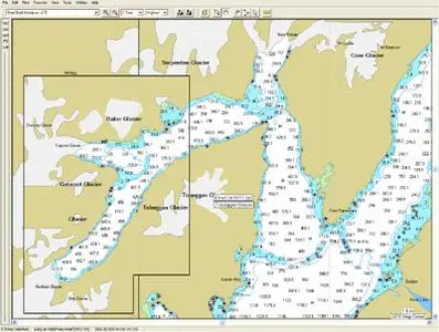
• Enhanced coverage of areas in Canada with new data from NDI
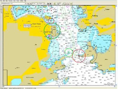
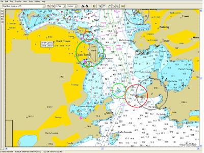
• Object-oriented cartography
• Faithful representation of published official paper charts
• Shaded depth contours
• Intertidal zones
• Spot soundings
• Navaids with view range and coverage
• Port plans
• Port services including marina names, addresses, telephone, and types of services provided
• Chart-specific information, including chart name and number, scale, revision date, latest Notice to Mariners date
• Tides, wrecks, restricted areas and anchorages
• Trip and waypoint management function lets you transfer waypoints, routes and tracks between your GPS and your PC
• Real-time track plotting allows you to interface your Garmin chartplotter or handheld GPS with a PC laptop and must have compatible GPS with unlock code
Download rapidshare (50MB parts):
PART 1
PART 2
PART 3
PART 4
PART 5
PART 6
PART 7