

Aquaveo GMS v7.1.10

Aquaveo GMS v7.1.10 | 241 MB
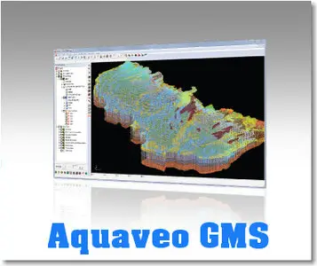
GMS is a comprehensive groundwater modeling environment with GIS based graphical preprocessing tools to automate and streamline the modeling process. GMS seamlessly interfaces with MODFLOW and several other preeminent groundwater models, and provides advanced graphical features for viewing and calibrating model results.
Features:
The Groundwater Modeling System (GMS) is a comprehensive graphical user environment for performing groundwater simulations. GMS consists of a graphical user interface (the GMS program) and a number of analysis codes (MODFLOW, MT3DMS, etc.). GMS is used as a preprocessor to graphically create numerical models, and as a post processor to import and visualize model results.
GMS uses a Conceptual Modeling Approach to create and manage numerical models using GIS based objects. Other powerful GMS features include 3D Model Conceptualization, Site Visualization, Advanced Geostatistics, Automated Calibration, and Stochastic Modeling. GMS also has advanced tools for Data Import, Data Export and Data Visualization and Animation.
What's new in GMS 7.1:
The following is a list of the more significant changes in GMS 7.1
1. New toolbar
The new toolbar includes tools for building polygons, running models, and for the Map -> X commands where X is a geometric object or numerical model
2. MODFLOW enhancements
1. MODFLOW MNW Package
2. MODFLOW HFB parameters
3. MODFLOW SFR parameters
4. Better handling of unsupported MODFLOW packages in the Name file
5. Model checker support for DRT, ETS and MNW packages
3. PEST
1. Support for the latest version of PEST
2. Parallel PEST
Now you can run PEST in parallel on your own computer to take advantage of machines with multiple cores
3. SVD and SVD-Assist
Now you use the Singular Value Decomposition option with PEST as well as the very powerful SVD-Assist method
4. UTEXAS enhancements
1. Pseudo-static analyses option support (seismic coefficient, Group K Sub-Command "SEI")
2. Tangent line support for starting circles
3. Interpolated shear strengths support
4. Fixed grid search support
5. Graphical editing of starting circle
6. Import of GeoStudio files
5. Simplified interface for GMS 2D mode
1. Hiding of tools and modules not in use
2. SEEP2D model automatically initialized from conceptual model
3. SEEP2D boundary conditions automatically mapped from conceptual model (no need to run Map -> SEEP2D)
4. Easily create all coverage types in one step
5. Feature object types automatically assigned based on coverage attributes
6. Allow only one conceptual model
6. New Redraw Display command to force recreation of all the display lists
7. Map to existing feature polygons when doing Shapes -> Feature Objects or ArcObjects -> Feature Objects
Home Page - www.aquaveo.com